The QALAQSI X Application
Every report is generated by the QALAQSI X application — a real-time satellite security platform monitoring 14,000+ orbital objects
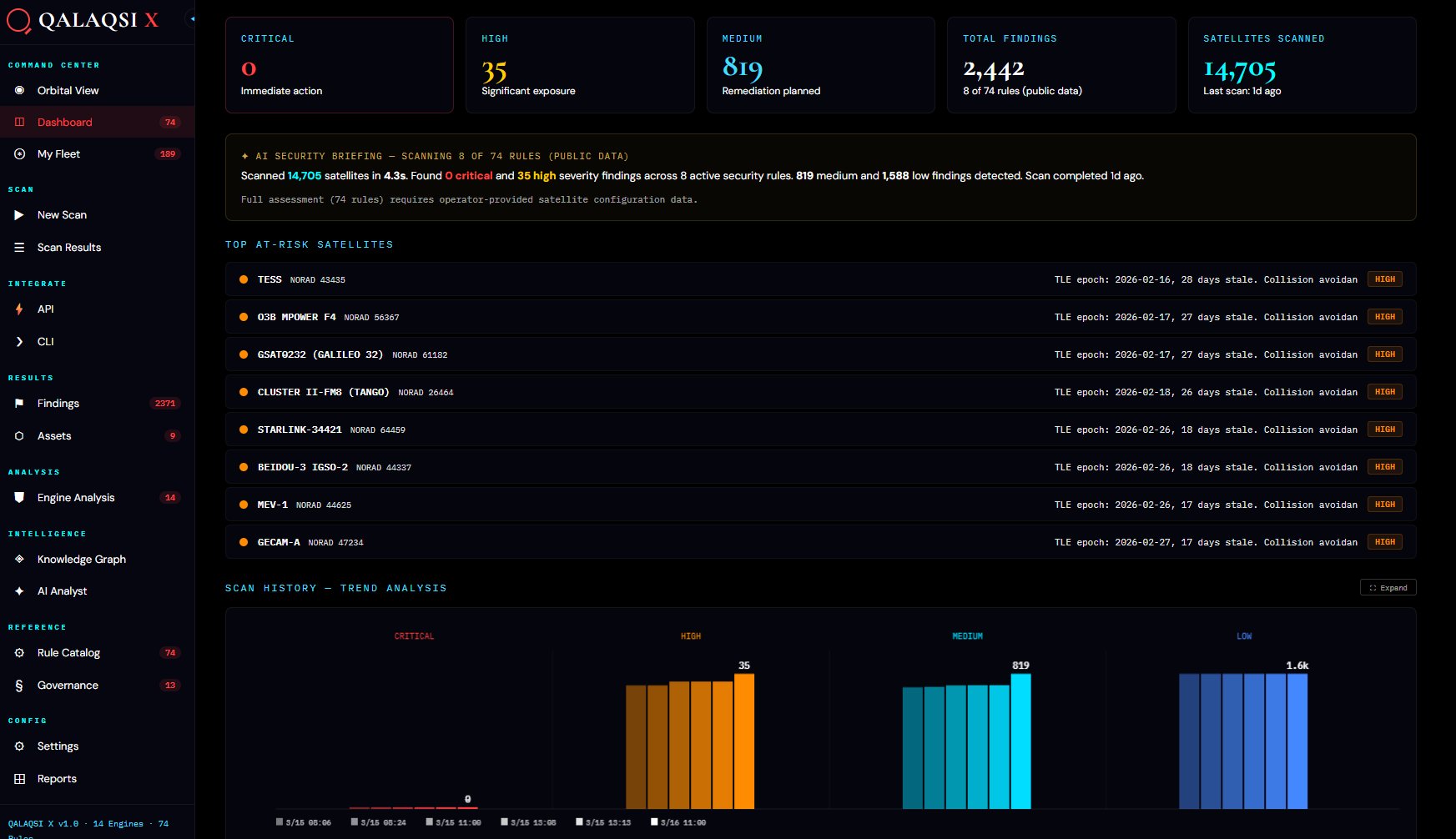
QALAQSI X Application
The QALAQSI X application continuously monitors the entire CelesTrak GP Catalog, computing real-time orbital positions via SGP4 propagation and evaluating each satellite against 75 security rules across 14 specialized engines.
When we generate a fleet assessment, the application isolates your constellation's satellites, runs the full rule set, and produces a personalized intelligence report with orbital visualization, severity analysis, and threat briefing.
75 RULES14 ENGINESREAL-TIMESGP4AI-POWERED